Rivière-Ouelle
Appearance
Rivière-Ouelle | |
|---|---|
 Sunset on St Lawrence River in Rivière-Ouelle | |
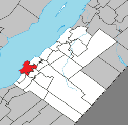
 Location within Kamouraska RCM | |
| Coordinates: 47°26′N 70°01′W / 47.433°N 70.017°W[1] | |
| Country | |
| Province | |
| Region | Bas-Saint-Laurent |
| RCM | Kamouraska |
| Constituted | July 1, 1855 |
| Government | |
| • Mayor | Louis-Georges Simard |
| • Federal riding | Montmagny—L'Islet—Kamouraska—Rivière-du-Loup |
| • Prov. riding | Côte-du-Sud |
| Area | |
| • Total | 147.10 km2 (56.80 sq mi) |
| • Land | 57.50 km2 (22.20 sq mi) |
| Population | |
| • Total | 995 |
| • Density | 17.3/km2 (45/sq mi) |
| • Pop 2016-2021 | |
| • Dwellings | 626 |
| Time zone | UTC−5 (EST) |
| • Summer (DST) | UTC−4 (EDT) |
| Postal code(s) | |
| Area code(s) | 418 and 581 |
| Highways | |
| Website | www |
Rivière-Ouelle (French pronunciation: [ʁivjɛʁ wɛl]) is a town located in the Kamouraska Regional County Municipality within the Bas-Saint-Laurent region of Quebec. It is located on the Saint Lawrence River; the Ouelle River flows through the town. It was part of the seignory of La Bouteillerie, once owned by Charles Deschamps de Boishébert et de Raffetot. Jean-Charles Chapais, a Father of Canadian Confederation, was born here.
Geography
[edit]
Rivière-Ouelle lies on the south shore of the Saint Lawrence River.
Communities and locations
[edit]The following designated areas are within the municipality's boundaries:[1]
- De Saint-Just (47°27′07″N 70°00′05″W / 47.45194°N 70.00139°W) – a hamlet located on Route 132
- Pointe-aux-Orignaux (47°29′07″N 70°01′21″W / 47.48528°N 70.02250°W) – a hamlet located on Anse de Mercier (Mercier Bay)
- Pointe-de-Rivière-Ouelle (47°26′02″N 70°03′01″W / 47.43389°N 70.05028°W) – a hamlet located on the shore of the Saint Lawrence River
Government
[edit]Municipal council
[edit]- Mayor: Louis-Georges Simard
- Councillors: Lorraine Demers, Marie Dubois, Rémi Faucher, Gilles Martin, Yves Martin, Léo-Paul Thibault
See also
[edit]References
[edit]- ^ a b "Banque de noms de lieux du Québec: Reference number 53626". toponymie.gouv.qc.ca (in French). Commission de toponymie du Québec.
- ^ a b "Répertoire des municipalités: Geographic code 14065". www.mamh.gouv.qc.ca (in French). Ministère des Affaires municipales et de l'Habitation.
- ^ a b "Census Profile, 2021 Census - Rivière-Ouelle". 15 November 2023.
External links
[edit] Media related to Rivière-Ouelle at Wikimedia Commons

