Pic la Selle
Appearance
| Pic la Selle | |
|---|---|
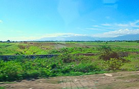
 Pic la Selle, seen from the Cul-de-Sac plain | |
| Highest point | |
| Elevation | 2,680 m (8,790 ft)[1] |
| Prominence | 2,650 m (8,690 ft)[1] |
| Listing | |
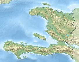
| Coordinates | 18°22′N 71°59′W / 18.367°N 71.983°W[1] |
| Geography | |
| Location | Haiti |
| Parent range | Chaîne de la Selle |
Pic la Selle (French pronunciation: [pik la sɛl]; Haitian Creole: Pik Lasel), also called Morne La Selle, is the highest peak in Haiti at 2,680 metres (8,793 ft) above sea level.[2] The mountain is part of the Chaîne de la Selle mountain range. It is located in the Ouest administrative department.
References
[edit]- ^ a b c "Pic la Selle, Haiti". Peakbagger.com. Retrieved 2013-02-16.
- ^ "Caribbean Area". Peakbagger.com. Retrieved 2014-03-01.
External links
[edit]

